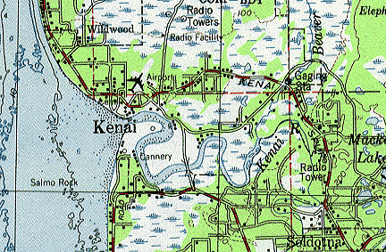
The location I chose for my historical map overlay is the city of Kenai, AK. I chose Kenai because it had one of the better-quality historical maps I could find of an Alaskan city (I found that searching for older maps of Alaskan cities was difficult, as many of them were topology maps). I also chose Kenai due to its mix of roads and waterways to be overlaid.
The historical map was created by the US Geographical Survey (USGS) in 1959 (with some revisions in 1987 (I don’t know what those revisions are)) (1):
Here is the Google Earth satellite image of Kenai with the USGS map overlaid:
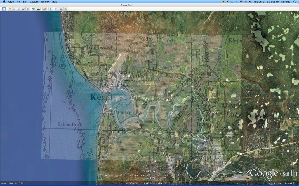
Performing this exercise has made me think about the accuracy of maps over time, especially with the advent of satellite imagery. I noticed how accurate the USGS map was in comparison to the satellite image as I was able to locate and match up the roads and waterways easily. However, I can’t say for sure that Kenai didn’t change between 1959 and the present day because I was able to find a difference in the depiction of Beaver Loop Road.
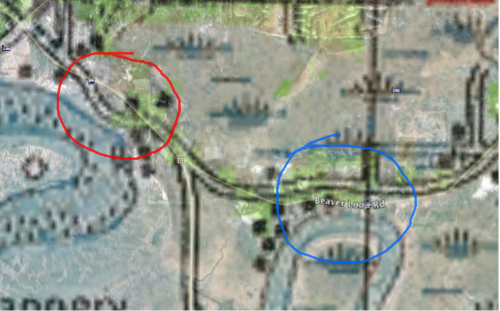
Beaver Loop Road is marked in a thin white line by Google Earth and is marked in a think white line (black on the edges) by the USGS map. The first difference I noticed, circled in red, has Beaver Loop Road on the USGS map closer to the Kenai River, while the road on Google Earth is away from the river. The next difference, circled in blue, is the direct opposite as the road on the USGS map is now away from the river, while the road is closer to the river on Google Earth.
I am not sure why Beaver Loop Road is depicted differently on the map and satellite image while the other parts of the map, as far as I could see, were accurate to the satellite image. Perhaps the road was modified since 1959? I can’t imagine it being modified for safety reasons as the road is moved closer to the river the satellite image. Perhaps the USGS map isn’t as accurate as I though it was? The map was made over 50 years ago, so it’s understandable if it has some inaccuracies. What about the map’s revision in 1987? Should have some of its inaccuracies been fixed then? Anywho, the overall accuracy the USGS map does show that historical maps can be quite reliable, even in the age of satellite imagery.
—-
(1) USGS. Map of Kenai Area. 1959, 1987. Alaska Climate Research Center.